Map the Museum logo
An unusual experiment
At the Royal Pavilion and Museums we have launched a new web project: Map the Museum. It’s an unusual experiment for us, and we need your help. Map the Museum allows users to browse through a selection of objects from our collections and pin them to a map of Brighton & Hove. The objects are initially taken from our Fine Art, Local History, and Archaeology collections. They will include prints, photographs, pieces of ephemera, objects made or sold locally, and items that have been excavated within the city. All have a link to Brighton & Hove in one form or another.
Why do we need your help?
The answer’s very simple. We don’t know everything. There is a great deal of local knowledge in the city, and My Brighton and Hove is a good example of how that knowledge can be pooled and shared. With Map the Museum we are trying to tap into this in order to improve the information we hold about our collections.
Published as ‘open data’
But that’s not all. The information gathered by Map the Museum will be published as open data. This means that it can be re-used by anyone else, free of charge. Hopefully, this will encourage others to develop applications using this data. With the enormous popularity of mobile devices such as smartphones, there are great opportunities for location data to be used creatively.
To help us in this task, we appreciate your feedback. You can submit comments via the Map the Museum blog.
Kevin Bacon
Digital Development Officer
The Royal Pavilion and Museums
Click on the map to open a large version in a new window.
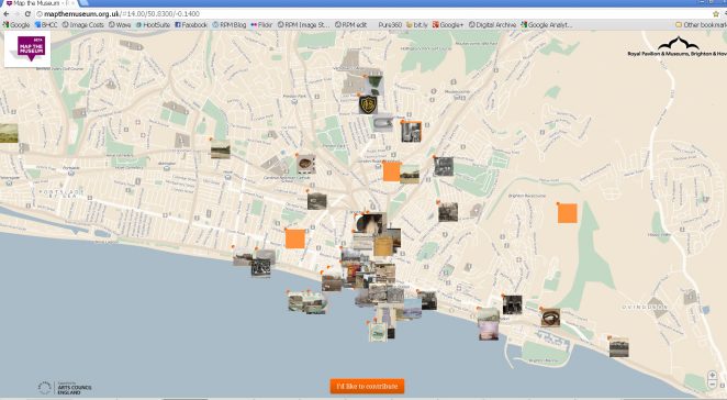
Map the Museum interactive map


No Comments
Add a comment about this page