A potted history
Please note that this text is an extract from a reference work written in 1990. As a result, some of the content may not reflect recent research, changes and events.
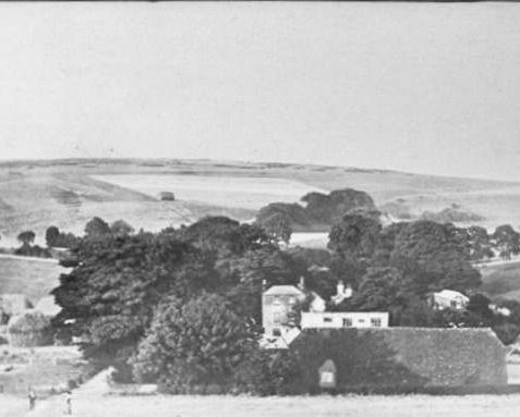
The Domesday Book of 1086 recorded the manor of Bevendean, ‘Beofa’s valley’, to be worth £6 and held by one Walter from William de Warrenne. It was eventually divided between two estates, Lower and Upper Bevendean, which were acquired by the corporation in November 1913 and January 1940 respectively; the whole Bevendean area was annexed by the county borough from Falmer parish on 1 April 1928. Lower Bevendean Farm was originally accessed from Bear Road by a trackway now known as Bevendean Road and had an eighteenth-century farmhouse, but the buildings were demolished to provide the open space known as Farm Green between Auckland Drive and Bevendean School. Upper Bevendean Farm survives however, and has a late-nineteenth-century farmhouse approached from Warren Avenue, Woodingdean. {1,282,289,305}
The first development of the Lower Bevendean estate came in the early 1930s when the corporation extended its housing from South Moulsecoomb up the valley on Bevendean land: thus 85-123 and 110-120 The Avenue (eastwards from the cross roads at the western end of Manton Road), plus Lower Bevendean Avenue, Upper Bevendean Avenue and Manton Road, are part of Bevendean. At about the same time, the Widdicombe Way/ Bevendean Crescent area was developed privately and was also known as part of the Bevendean estate, but it is now normally counted as part of the Moulsecoomb district. {83}
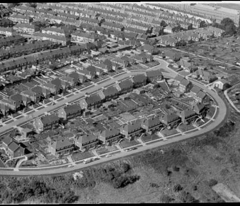
With a pressing need for new homes in the post-war period, the greater part of the Bevendean housing estate was rapidly developed higher up the valley from 1948 by the corporation, which named the roads after English castles. The population of Bevendean is now around the 4,000 mark {277}. Bevendean Barn, at the corner of Auckland Drive and Heath Hill Avenue, was used as a chapel for the estate from 1953, but it was replaced in 1963 by the Church of the Holy Nativity, a Modern-style building in brick, mottled knapped-flint and cobbles by Richard Melhuish Ariba. The industrial estate at The Hyde was developed from 1955; the first factory was Elizabeth English shoes, followed by Hibberd furniture, Brighton Sheet Metal works, Redifon, Canada Dry and Gulton Europe. {83,123,124,311}
Any numerical cross-references in the text above refer to resources in the Sources and Bibliography section of the Encyclopaedia of Brighton by Tim Carder.


Comments about this page
Looks more like Jevington Drive to me.
The Widdicombe Way/Bevendean Crescent area, lying between South and East Moulsecoomb, is known as ‘Higher Bevendean’, and is not generally regarded as part of Moulsecoomb.
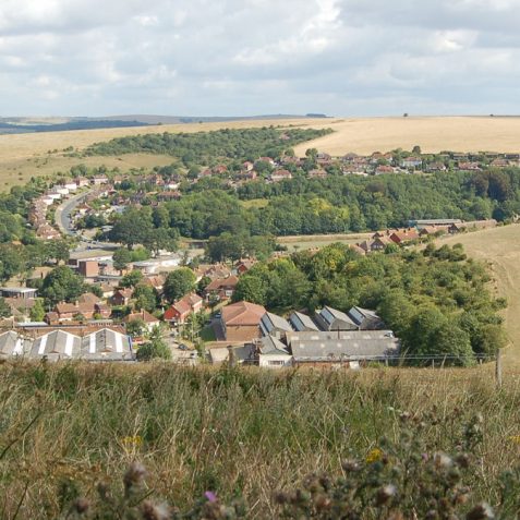
Hi I used to live at 78 Auckland Drive, we moved there in 1952 I was 3 or 4 at the time? I can just make out the building towards the mid right of this photo. I certainly remember having many happy times playing cricket / football with the Taskers, Fairhalls, Bakers et all. on the small green beside Ludlow Rise. Also I remember that 1962/63 winter. If this photo is 2006, it is very little different than I remember it. Thanks
I’m sure “the Hyde” is the back of Bevendean where the industrial estate is?
The Church of the Holy Nativity is no longer a working church but is instead a community centre providing a space for local meetings, regular classes including yoga and for local artists to exhibit during Open House seasons twice annually.
I’m sure you are right John. At the top of the picture you can make out the old Allen West buildings on Lewes Road on the site now occupied by the car park for Mithras House, part of the Brighton University complex.
That is Jevington Drive in Bevendean, not the Hyde in Lower Bevendean .
I am so glad I have read this. I have lived in Widdicombe Way since 1976 and it has always been called Higher Bevendean. Our local council seem to differ in opinion. My late aunt and uncle lived here when the houses were first built in 1931; when Braybons bought the land and built the private estate. This estate consisted of six roads: Widdicombe Way, Bevendean Crescent, Medmerry Hill, Nyetimber Hill, Beech Grove and Hillside Way. We had our own Bevendean Hotel and still have our own post office at No 36 Widdicombe Way, called Higher Bevendean Post Office.
My first house in the late 1970s was in Widdicombe Way. I still remember doin it up and removing the old air raid shelter near the back door. I still live in the Brighton area.
That is definately not The Hyde ,Lower Bevendean. I’m amazed that the photo’ has not been replaced over the course of the 12 years that have now passed since the page was added.
So many things are wrong about this piece of history. Apart from the picture of what was supposedly the ‘Hyde’ and was not, the details of Bevendean farm are also incorrect. It would not have originally been accessed by the track leading down from the top of Coomb Rd area but through the valley which became the avenue into Heathill Ave. Why would they drive over a steep hill to the farm with horses and carts when the valley way was much more accessible. I actually lived in Bevendean when the farm and its buildings were still there long before they were demolished.
Add a comment about this page