Old Town to North Laine

Please note that this text is an extract from a reference work written in 1990. As a result, some of the content may not reflect recent research, changes and events.
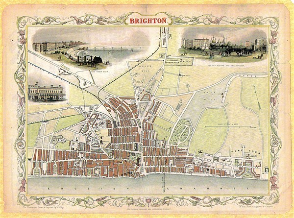
The following tables list the roads and streets of the borough of Brighton with the approximate dates of their first significant development. This information has been derived from contemporary plans and directories in periods of approximately five or ten years, and the town has been divided into convenient districts for ease of use. It should be noted that many roads, particularly in the Patcham , Rottingdean , Saltdean and Woodingdean areas, were developed piecemeal over many years, while other roads, mainly in the town centre, have been rebuilt since their initial development. Current road names are used in all cases, but streets no longer in existence are shown in italics. The reader is advised to use these tables in conjunction with a street-plan. {10,83,107,108,109}
i) Old Town area (bounded by West Street, North Street and Old Steine):
pre-1665: Bartholomews; Black Lion, Boyces, East, Little East, Market (north), Middle (south), North, Ship (south), Union & West Streets; Brighton Place; King’s Road; Meeting House Lane; the lower town below the cliff.
1665-1744: Market (south) & Middle (north) Streets; PoolValley; Steine Lane.
1745-79 Castle Square ; Duke, Nile & Ship (north) Streets; Old Steine (south & west).
1827-30: Grand Junction Road.
1842-7: Prince Albert Street.
1963: Regent Arcade.
1966: Brighton Square.
1979: Dukes Lane.
ii) Regency Square area (bounded by West Street, Western Road and Hove boundary):
1780-8: King’s Road (east of Russell Street); Little Russell, Russell & Upper Russell (north) Streets.
1788-99: King’s Road (Russell Street-Regency Square).
1800-8: Clarence Square (north side); Grenville Place; King’s Road (west of Regency Square).
1808-21: Bedford, Regency & Russell Squares; Blucher Place; Cannon Place & Street; Norfolk, Upper Russell (west) & Western Streets; Western Road (south side to Castle Street).
1822-9: Castle, Clarence, Little Preston, Little Western, Preston & Sillwood Streets; Cavendish, Oriental, St Margaret’s & Sillwood Places; Montpelier Road (east side); Norfolk Square; Sillwood Road (east side); Western Road (south side west of Castle Street); Western Terrace.
1831-5: Bedford Place; Cranbourne Street; Montpelier Road (west side).
1842-7: Artillery Street; Clarence Square (south side).
1869-75: Sillwood Road (west side).
1969-72: Churchill Square.
iii) Clifton Hill area (bounded by Western Road, Dyke Road and Hove boundary):
1665-1744: Dyke Road (south of Upper North Street).
1809-21: Western Road (north side to Hampton Place).
1822-30: Crown, Dean, Marlborough & Spring Streets; Montpelier Road (west side) & Terrace; Norfolk Square (north side); Regent Hill & Row; Vine Place; Western Road (north side west of Hampton Place).
1831-5: Borough & Temple Streets; Hampton Place; Montpelier (west side) & Norfolk Roads.
1837-41: Victoria Street.
1842-7: Clifton Hill, Road & Terrace; Goldsmid Road; Montpelier Crescent, Place, Street & Villas; Upper North Street; Victoria Place.
1848-53: Belvedere, Norfolk & Vernon Terraces; Clifton Place; Dyke Road (Clifton Road to Seven Dials); Powis Grove, Square & Villas; Victoria Road.
1865-9: Denmark Terrace; Dyke Road (Upper North Street to Clifton Road); Powis Road; St Michael’s Place.
1900-9: TempleGardens; Windlesham Avenue, Gardens & Road.
1987: Marlborough Mews.
iv) West Hill area (bounded by Dyke Road, Queen’s Road, railway, New England Road, and Chatham Place):
1665-1744: Air Street; Dyke Road (south of Upper North Street).
1800-8: ZionGardens.
1809-21: Mount Zion Place; New Dorset Street; NorthGardens.
1821-30: Church Street; CrownGardens.
1831-5: Queen’s Road (west side Church Street to North Road).
1836-41: Kew Street; Surrey Street.
1842-7: Camden Terrace; Guildford Street; Queen’s Road (except west side Church Street to North Road); Terminus Place, Road & Street; Upper Gloucester Road.
1848-53: Bath, Clifton & Railway Streets; Buckingham, Chatham & Howard Places; Dyke Road (Clifton Road to Seven Dials); Queen Square; Russell Crescent.
1854-8: Buckingham (north), Centurion & Guildford Roads; Compton Avenue; West Hill Place, Road & Street.
1865-9: Albert, Buckingham (south), Dyke (Upper North Street to West Hill Road) & St Nicholas Roads; Buckingham Street.
1870-4: Alfred & Leopold Roads; Alexandra Villas.
v) North Laine area (bounded by North Street, Valley Gardens, Trafalgar Street and Queen’s Road):
1745-1779: Bond Street (south); King, Marlborough & Prince’s Places.
1780-9: Bond (north), Jew, Portland & Windsor Streets.
1789-99: Church Street (east of SpringGardens); King Street; SpringGardens.
1800-8: Gloucester Place.
1809-22: Bread, Gardner, Jubilee & Regent Streets; Frederick Place; Kensington Gardens; New Road; North Road (south side); Orange Row; Pimlico.
1823-30: Church (west of Spring Gardens), Gloucester, Kensington, Upper Gardner & Vine Streets; Frederick Gardens & Street; Kensington Place (west side); North Road (north side); St George’s Place.
1836-41: Robert & Tidy Streets; Kensington Place (east side); Trafalgar Terrace.
1842-7: Blenheim & Cheltenham Places; Foundry, Kemp & Trafalgar (south side) Streets; Gloucester & Queen’s Roads; Pelham Square (west side); Queen’s Gardens.
1848-53: Over & Sydney Streets.
1859-64: Pelham Square (south & east sides).
1870-4: North Place.
1875-9: Tichborne Street.
Any numerical cross-references in the text above refer to resources in the Sources and Bibliography section of the Encyclopaedia of Brighton by Tim Carder.


No Comments
Add a comment about this page