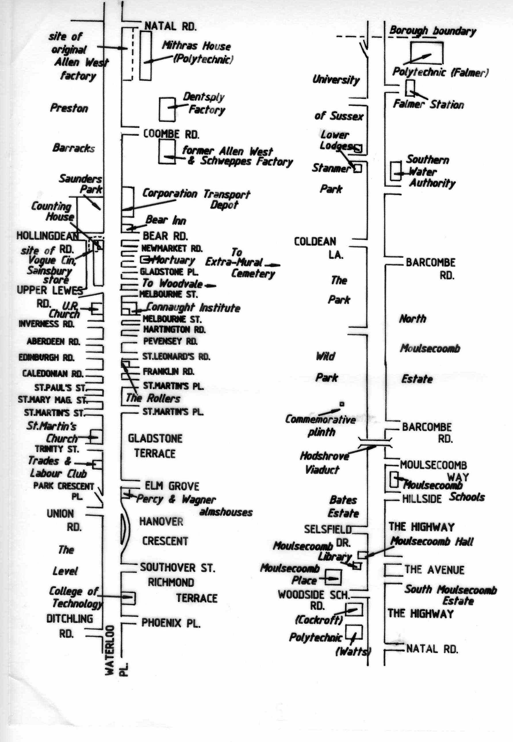
Click on the image for a full-sized version of the diagram
Diagram of streets and buildings

Lewes Road
Reproduced with permission from the Encyclopaedia of Brighton by Tim Carder, 1990
Photos and articles about Brighton and Hove in the time of coronavirus. See our collection and add your own!
Click on the image for a full-sized version of the diagram


Comments about this page
I have to point out that this map shows St. Paul’s Street and St. Mary Magdelaine Street in the wrong positions. St. Paul’s Street was most certainly the southern one of the two, backing onto St. Martin’s Street. I lived at No. 21 St. Paul’s Street which was a former bakery located on the corner of St. Paul’s Street and Park Crescent Road from 1959 until 1971.
Unfortunately some former historical landmarks that appear in people’s personal reminiscences are missing from the above plan. Coxes Pill factory, the former railway Viaduct to Kemp Town and the Hollingdean Pumping Station, were all on the western side between Upper Lewes Road & Hollindean Road.
Coombe Terrace is still opposite the Barrack site. It may also help anyone searching for a particular house in Lewes Road to remember that in the case of this road, the numbering went up the western side and then back down the eastern.
Add a comment about this page