Click on the image to see a full-sized version.
Please read our Terms and Conditions in regard to usage of this image
Photos and articles about Brighton and Hove in the time of coronavirus. See our collection and add your own!
Click on the image to see a full-sized version.
Please read our Terms and Conditions in regard to usage of this image


Comments about this page
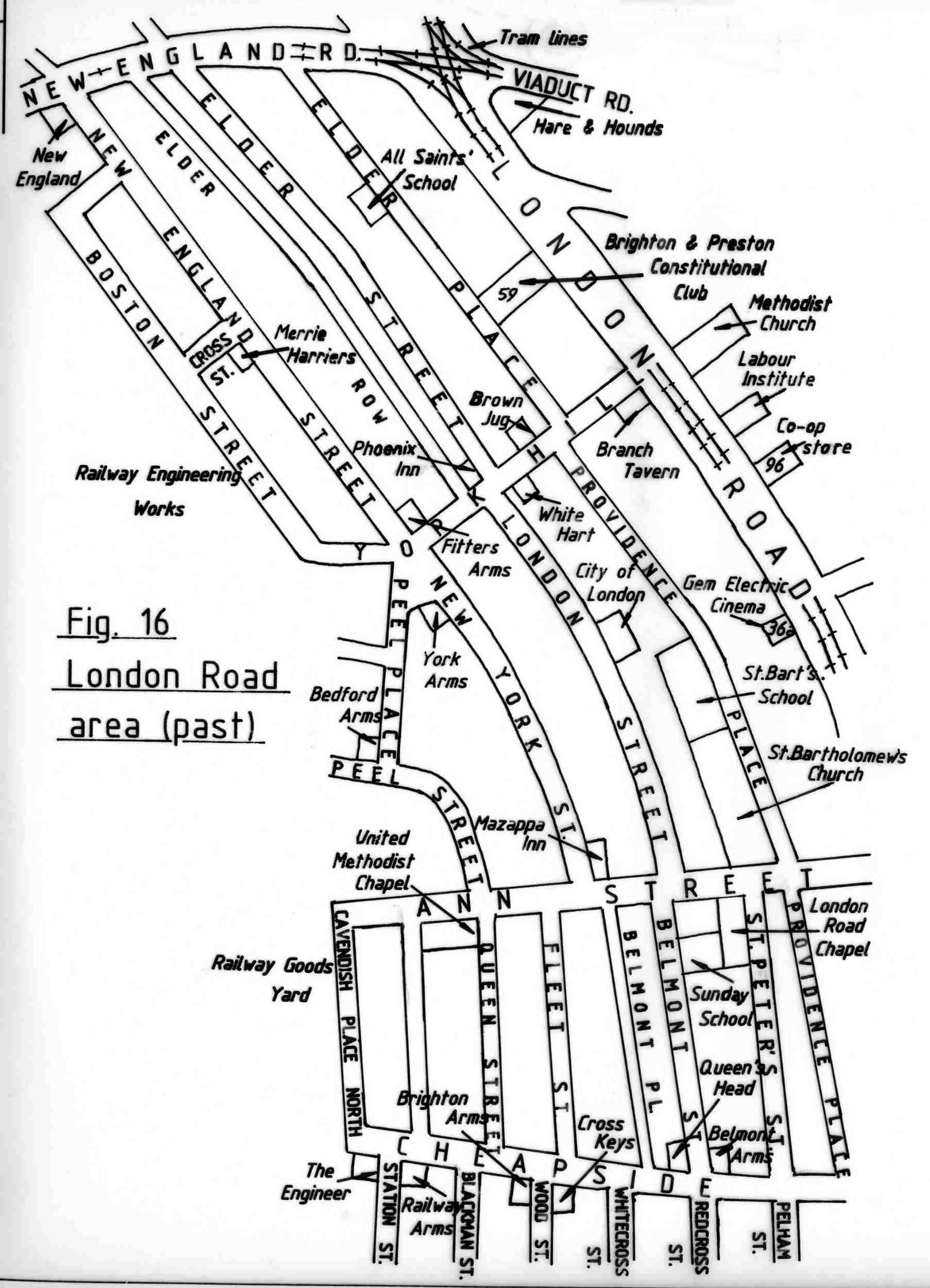
There is no date on the map for before redevelopment. When I lived in Ann St in the 50s, there were no streets above Fleet St. The railway goods yard and Ffyees went from the top of Cheapside all the way along to New England Road.
When Tim Carder was producing his masterpiece, his intention with the ‘before’ maps was to give an idea of the complex urban framework before mid 20th century clearance. Thus there are streets,inns and taverns, churches and chapels from a range of dates. Andy will know the exact dates, but Peel Place and Street, and Cavendish Place North in the west of the map all disappeared when they extended the railyards and workshops in 1905 (I think)!
Hi Chris / Geoff, I agree with Geoff’s summary that the map is most probably representational of the area, largely based on the street layout around the turn of the 19th/20th centuries. The streets Geoff mentions were subsumed by the railway yards in 1905. Regards, Andy.
Add a comment about this page